(707) 269-2058 • RCAA/NRS 904 G St. Eureka, CA 95501
Road Assessment and Restoration Planning in the West Ishi Pishi Watersheds, Six Rivers National Forest
Project Dates:
2008
Service:
Funding Organizations:
US Forest Service
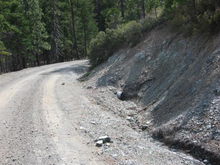
In 2007, NRS conducted a sediment source road inventory and analysis of US Forest Service roads within the Orleans District. The project entailed a field examination of selected US Forest Service roads within the project area and identified road related sources of sediment contribution to the stream network using an inventory protocol developed by the US Forest Service. A total of 188 miles (163 roads) of system and non-system roads were inventoried by field crews. Crews evaluated potential and active sediment contribution from road surface, stream crossings, cross drains, and erosional features to the stream network. Data was collected and the location of each feature was recorded with a GPS unit. Field data, along with a risk assessment model and GIS modeling, was used to identify high priority sites for treatment. Treatment recommendations for sites requiring decommissioning, upgrades, or maintenance were made in the field. All field data, analysis, and GIS layers were added to the Six Rivers National Forest road database.
To view the final report from this project, "Road Assessment and Restoration Planning in the West Ishi Pishi Watersheds in the Lower Middle Klamath River Basin," please contact Tyler Ledwith at tyler@nrsrcaa.org.